


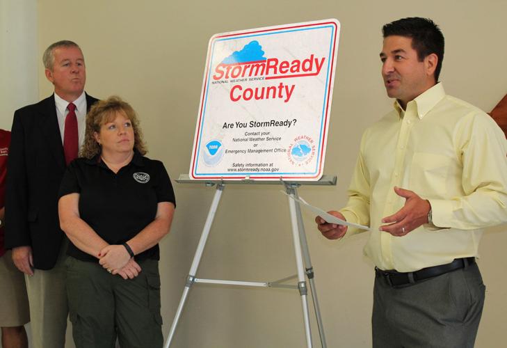
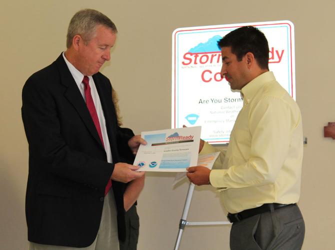
The National Weather Service in Morristown has officially designated Loudon County as StormReady, a program that recognizes communities with multiple means of communication in the event of severe weather.
Representatives from Loudon County government, Emergency Management Agency, Lenoir City Fire Department and E-911 Center were on hand Wednesday at the County Office building to accept a certificate and street sign from NWS Warning Coordination Meteorologist Anthony Cavallucci recognizing the accomplishment. Tennessee Emergency Management Agency representative Bob Crane was also in attendance.
“This is a recognition and a product of the National Weather Service,” Daryl Smith, EMA director, said. “They have what they collectively call ... (Weather-Ready) Nation and here in Loudon County the StormReady means that we have multiple modes of communication for early warning and alerting of our citizens of any weather dangers to the community. That’s tornado, thunderstorm, ice, snow, everything — or even high winds.”
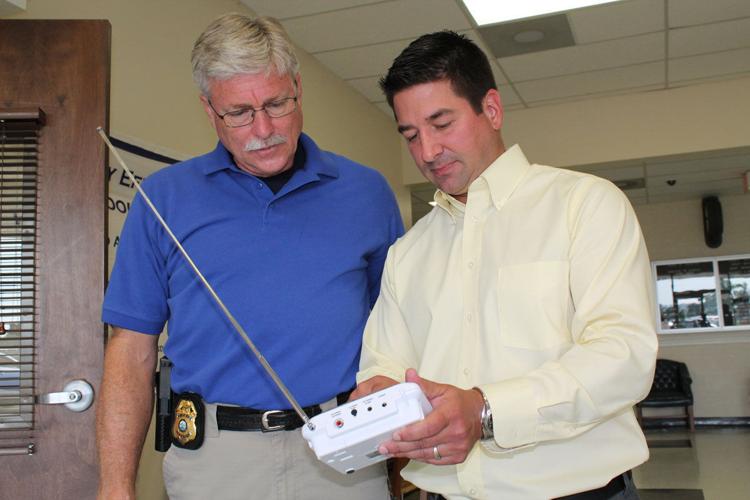
Wednesday’s ceremony was about two years in the making. County officials had to go through a checklist of items before the title was given, including obtaining a weather station, which is located at the 911 center, and placing weather radios in county offices and schools. The county updated its mass alert system last year, called Hyper-Reach, ensuring anyone within reach of a cellphone tower can get emergency alerts.
“I think the biggest significance is that we are receiving the information about weather or potential bad weather from multiple outlets now,” Jennifer Estes, E-911 director, said. “We have a weather station at 911. We have, of course, the weather radios. We get direct contact from TEMA and the National Weather Service, and then we’ve also partnered with Emergency Management in order to be able to get the information out through multiple outlets.”
Located in each school is a radio that alerts officials on weather watches and warnings, Smith said.
“When the weather service sends out their weather watches and warnings, when they send those out that radio, they send it out on their regular VHF broadcast channels, and that radio stays silent until they activate it with the tone,” Smith said. “... There’s one for every county, a tone specific to each county. So you select a tone in those radios — you select a county you’re in and then it knows what tone you’re talking about so that when they send out a tornado watch or warning or severe thunderstorm warning or watch, those things open up and the voice broadcast from the weather service comes across it.”
Loudon County is one of only two counties in East Tennessee with Integrated Public Alert & Warning System certification, Smith said. IPAWS is a federal warning system through the Federal Emergency Management Agency that is similar to the national alert system coming across a television. In order to obtain the certification, Smith said officials needed specific training.
“And that system through our Hyper-Reach program ... which is a contract public alert system, or computer software, that allows us to be able to send messages to individual ... cellphones whether or not they’ve subscribed to anything,” Smith said. “Regardless of whether you have signed up to the Hyper-Reach program on the software, the network on our website, if there is a tornado, imminent danger, something happens at (Department of Energy), any type of imminent tornado warning, we can broadcast those things out to your cellphone on a text message and voice message to your phone.”
Smith said the weather station was purchased last year through a $16,000 no-match grant from the Department of Energy. About $1,000 went toward the weather station and the software. The weather station can read temperature, wind speed and direction.
“It’s about preparedness and notifications, being able to get as much notification to as many people as early as possible and have those multiple means of notifications overlapping layers of getting the information out,” Smith said.
For the past two years, EMA has conducted weather spotter classes and the goal is to continue that this year. Smith said a course is held in the spring before severe weather typically begins, and the National Weather Service offers instruction and certificates of training to those who pass.
“Basically, you’re reading the sky,” Smith said. “What did you see? What are you seeing now and giving indications as to whether you hear somebody say weather spotters confirmed a funnel cloud touched down at so and so, that type of training that the weather services comes and does.”
Cavallucci said having the StormReady designation will allow the county to receive discounts, notably in a flood insurance program.
“So it should cost less for the county once they note that they are a StormReady community, or county, and they can apply for that reduction in the flood insurance program,” Cavallucci said. “Here being along the Tennessee River and other tributaries, that could assist in helping the county save some money. ... It doesn’t mean that they’re storm proof obviously, but it’s to better prepare (them) to handle severe weather.”
Other StormReady counties include Monroe, Knox, Blount and Roane. A full list can be found at www.stormready.noaa.gov.
Smith said the plan was to place the StormReady sign at each of the major thoroughfares in the county. The signs cost $50 apiece, and Smith said placements should be made within about two weeks.
“I think for the safety of our people it means something, and it means something for the people who come into the county,” County Commissioner Henry Cullen, who also serves as the EMA board chairman, said.


